Monday, February 19, 2018

Country Roads and Tasty Pastries

After failing to finish the Luck of the Drawbridges on Thursday, I didn't think that I would have a chance to try another permanent populaire so soon. But, after a gorgeous Saturday, I awoke the next morning to a forecast calling for an almost-as-nice Sunday. Since my legs felt good, I quickly signed up for the "Baked Goods 100" (RUSA route 2651) using the SIR "Perminator" and then got everything loaded into my car.

I had signed up for a 10 am start, so leaving the house just after 8 it seemed like I would have no problems. Then a Mercer Island policeman pulled me over on I-90, and I thought that I was doomed. Fortunately, it was just because my tags had expired and he let me off with a warning.


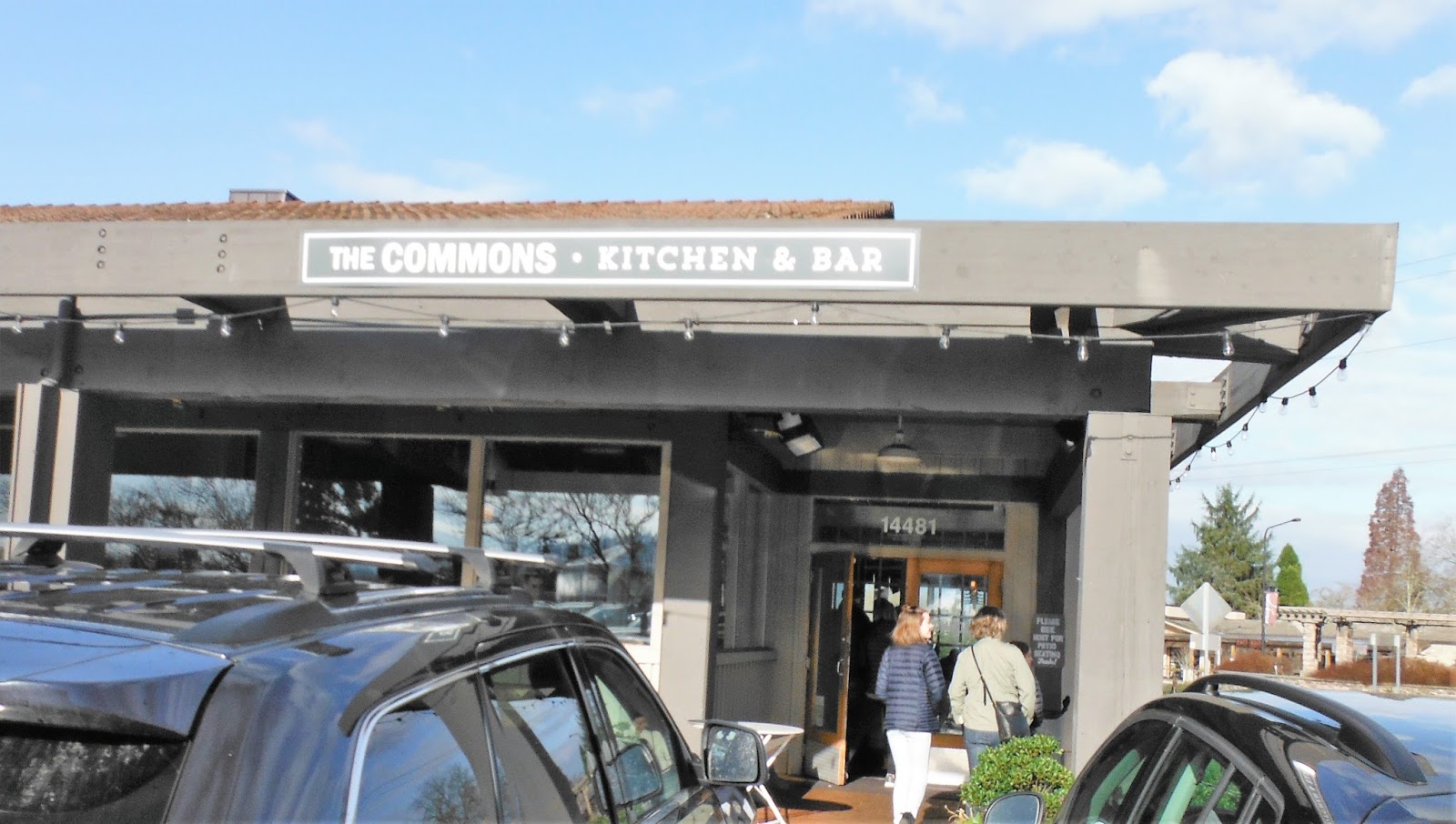
The first control is open at an area called The Commons in Woodinville. I found a good parking spot in a park next to the Sammamish River Trail and then rode up to this place before 9:30. For once, I had time to eat a cinnamon roll and have a couple of cups of coffee.

By the time I hit the road at 10 am, it had warmed up a bit but was still foggy. The route had me get on the Sammamish River Trail, and I recognized where I was on that trail about the time that I got off of it near downtown Woodinville. I cruised through town on a nice road with a good bike lane, and then climbed for about a mile and a half up onto the ridge. From there, the roads were quiet and rolling, and soon the last of the clouds cleared away.


The road dropped down into a pretty valley full of farms, and the quiet roads continued as I approached Snohomish. I passed a group of four cyclists on a training ride headed the other way, and they all waved and called "hello." It was nice that they were friendly, but I could also tell that they were trying to figure out who this new randonneur (obvious because of the bags and lights on my bike) was. Seattle may have a lot of cyclists, but it's still a small community.


Control #2 is a popular one in the area -- the Snohomish Bakery at First and Union. Although I was not exactly cruising, I had plenty of time for another pastry and a cup of coffee. On the way out of town, I saw more cyclists coming in.


I retraced the same roads that I had used to get to Snohomish for a few miles, and then veered left towards the river.


This made for a long ride over gently rolling hills, with many flooded fields off to one side presenting a gorgeous view.


Many of the trees in Washington are coated in moss, so they look like they're wearing puffy green sweaters. Otherwise, this could have been a road in middle Tennessee.


Eventually, the route crossed over the river and got onto a multi-use trail that follows Hwy 203 in to Carnation. This was my least favorite "road" of the route, since the trail was small gravel that got slippy at about 15 mph on it -- and I was running 32C tires! Although it had a good number of cars, I would have preferred to have been on Hwy 203 here.

In Carnation, I stopped at another bakery for coffee and a pastry. This time, it was a bacon and cheese biscuit, so it probably passed for lunch. I sat outside the restaurant and ate, noticing that the wind had come up a bit and the temperatures felt cooler.


Leaving Carnation, the route was on more quiet farming roads.


Soon, I passed by the farm that the town is named after ... or is it that the farm and company is named after the town?


I considered it ironic that a company whose name is synonymous with powdered milk -- an abomination that I grew up with such that it ruined coffee for me until I was in my 20's -- would be so close to a city that has become synonymous with good coffee. But they also make evaporated milk, and you can't make a real cuban coffee without evaporated milk.

Just past this farm the route begins a nice 3.5-mile climb up onto another ridge -- Union Hill and Novelty Hill. Again, the roads were wonderfully quiet and most of the cars well-behaved.


I went by a bunch of huge homes owned by software magnates, and then enjoyed a fun descent off the ridge. Almost immediately, I was in downtown Redmond. The roads were decent, with good bike lanes and very little debris, and soon I was on another series of multi-use paths. For part of this I had to dodge and trackstand folks walking their dogs and babies on a sunny afternoon, and then I was back on the Sammamish River Trail.

I was hungry for real food by now, having promised myself pizza at a place that I had seen at the start at the Commons, so I put my head down into the now-stiff headwind and motored north. Another cyclist tried to grab my wheel after a mile or so, but I was too hungry to back off and give him a pull.

Back in Woodinville at the Commons, everyone was out enjoying the sunny day. Fortunately, I didn't have to wait too long at the pizza place and my belly was soon full again. I didn't think to get my card signed until the end, so my time on the route -- while official -- did not look good.

But in spite of my poor time, I had a good time.

Sunday, February 11, 2018

(Un)Luck O' the Drawbridges

We had a nice break in the weather over the weekend, so Friday I skipped out of work about noon and tried to do my February metric. As time was tight, I decided to do a route that started just a few miles from our house in West Seattle -- RUSA permanent 2596: Luck O' the Drawbridges.

This is a fun route if you want to see some of the sights accessible to cyclists in Seattle. With 2600 feet of climbing, it's tough enough to give you a good workout. And it's a good learning experience for anyone who neglects one of the first rules of randonneuring: Research your route before you ride.

I failed to do that, which is why I did not officially finish this ride.

Naturally, I looked at the route map and elevation profile on RideWithGPS.com, and I looked over the cue sheet ... but the cue sheet was three full pages and I kind of got information overload. This looked like a good opportunity to try out my new Wahoo Elemnt Bolt -- which, by the way, I cannot fault for my failure to finish -- and see if it's as good at navigation as people say. I have to give the unit high marks for this, since it kept me on the route all day. But it was my own stupidity, and a little bit of laziness, that did me in.


The start was an Open Control, so I went to one of my favorite bakeries in West Seattle. I barely got there at the start time because I had to do some work, so only had time to get my card signed and buy a scone. I scarfed the scone while I loaded up the route on the Bolt (very fast load), and then followed the usual route into Seattle proper.


At this point, much of the route had been multi-use trails or bike lanes. (One complaint about the bike lanes in Seattle -- the ones in industrial areas have a LOT of debris.) The route from here turns onto a really nice trail that winds along the shore and up to the canal. There was an information control at mile 7.7 just after the start of this trail, and then another information control at mile 12 near the end.


After the trail, you turn on Fremont and cross your first drawbridge before climbing a long hill up into some lovely neighborhoods. After five miles of rolling through these, the route gets on the Interurban Trail for four miles before the third control at mile 21. And this is where I messed up.


This Starbucks was actually an information control, but I confused it with the control that was at mile 24.8. That Starbucks is a control-control.

So I stopped at the Starbucks at mile 21, but didn't stop at the Starbucks 3.8 miles later. Instead, I just blithely followed the route down a really fun descent and through a park and some quiet neighborhoods.


Then I got on the Burke-Gilman Trail and rode along the edge of the lake for another five miles.


So it was maybe mile 30 when I thought, "I wonder where my next control is." And that's when I realized that my route sheet had fallen out of my pocket (I think on that nice descent). So I stopped and pulled out the brevet card and realized that I had messed up.

Now, I briefly considered riding six miles back up the trail to the Starbucks that I had missed, but the problem was that wasn't enough. You see, the control that I had treated as a control-control was an information control, so I would need to go back to that one. That meant climbing that hill that had given me such a fun descent. With some effort, I probably could have made it back to the first Starbucks and gotten the information, and then come back to the second Starbucks by the closing time.

But it would be close. And it might have me finishing after dark.

And I just didn't want to.

So I went on with the route, but didn't bother with controls any more. At this point, it was just for fun and to see some stuff, and to test the route out for another day. No pressure.


We had a bunch of rain, and my weather app kept telling me there were mudslides. Here's one.


After passing through the university area, the route goes back over the canal on the Montlake Bridge (the second of the drawbridges) and gets on the Lake Washington Loop. This goes through the Washington Park Arboretum and then a bunch of huge houses on Lake Washington Road.


Rich people have nice boats.


For some reason, the wind was in my teeth for most of this stretch and I was working hard to keep my speed even close to 15 mph. It was a tough five miles.


At the end of Lake Washington Road, the route goes into Seward Park. It was really pretty in there on Friday, and since it was so nice there were a lot of folks out walking.


 After the park, the route headed back inland. This stretch was kind of yucky. There was a bike lane, but again you had to really watch out for broken glass and metal and rubber and just general crap. It gets worse on the other side of I-5 and Boeing Field.

The route passes through South Park ("they killed Kenny!") and then gets on the Duwamish Trail. Since I wasn't riding the route "for real" at this point, I got on W. Marginal Way here instead. The cars have no trouble passing me, and it's easier to go fast on roads than it is on trails. I also skipped the last few miles where the route goes on the Alki Trail and around the peninsula. I've done that part, and daylight was fading.

I might try this route again, since it's nice to be able to just ride to the start. But after I got home Friday I decided that the next route that I do out here needs to be something out in the country.

So that was what I did on Sunday. But I'll tell you about that next time.