Monday, March 26, 2018

What I Won't Do for an Apple Fritter

So I went to Puerto Vallarta for a week and hung out by the beach eating and drinking too much bad stuff with good friends, and not even touching a bicycle or really exercising at all.

It was great.

But, it didn't do much for my fitness. I felt like I needed to boost my base miles, and Saturday and Sunday here in Seattle were fairly nice -- a little cool and breezy, but at least not raining much -- so I headed out for a long ride on Sunday.


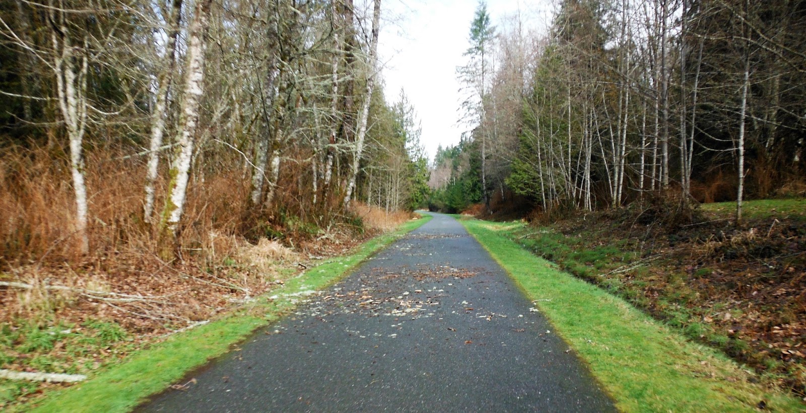
My route was one that I had planned online over a month ago, starting with a flat cruise south down the Duwamish, Green River, and Interurban Trails. It was early enough when I started -- and still lightly sprinkling -- so that the trails were fairly devoid of pedestrians. The roads were also less full of cars, so on most parts of the Duwamish Trail I was able to get on the road and not wind my way between the piles of debris prevalent on that multi-use trail.


The wind was out of the south at a steady 10 mph, so it was hard work to maintain a decent speed. I stayed mostly in the drops going down the Interurban, dreaming of how pleasant the wind would be later when I got to return north.

I had skipped breakfast and thus badly needed the latte and muffin I got at Zola's Cafe in Auburn. At that point, I was just over 25 miles in and considered heading back. But the skies had cleared when I finished my late breakfast, and I decided to do the loop up to Black Mountain.


One of these days I'd like to stop here and see what a flaming geyser looks like.

There were many cyclists coming back as I headed up the gentle grade, and I considered that maybe I was doing this loop the wrong way. But the inclines stayed mild and the road stayed wide enough to accommodate me and the somewhat frequent speeding cars. Soon, I was in town.


All of the routes that I had seen favored a stop at the Black Mountain Bakery, and I decided to take a break there. The apple fritter that I got was huge and very tasty, and was easily worth the labor of the climb.

Leaving town, I got on busy Hwy 169 heading south. When I got to the turn that my GPS wanted me to take, however, I saw that it was a dirt road. Assuming that my GPS was concerned about me staying on a busy road too long, I ignored it and continued south looking for a better option.

When I got to Green Valley Road, the sign indicated that it would go to Flaming Geyser State Park. For some reason, my brain rejected that, thinking that the road was doubling back too much, and so I stayed on Hwy 169.

Soon, the road had a long descent to a bridge over the Green River, followed by an even longer climb. It was about 2/3 of the way up this climb that I began to think that I should have taken Green Valley Road, but at that point the prospect of going back down that hill on that busy road and then climbing back up the other side did not appeal to me. Thus, at the top of the climb, I pulled out a phone and opened Google Maps. Sure enough, Hwy 169 was just going to continue south, away from home, and so I picked a series of smaller roads that would allow me to get back on route.


The countryside was quietly rolling to flat, with small farms and fields of grazing cattle. The roads were in good shape, and the few cars that I saw passed with plenty of room. At one of the many places where I stopped to consult Google Maps and confirm my direction, some kids in a passing car even gave me a "Woo-hoo." At least they no longer yell, "Go Lance!"


Finally I crossed back over the Green River and got on Green Valley Road, where I was supposed to be. As the name suggested, this road winds its way through a mostly flat and rather verdant valley. Although I was generally heading east, the wind had shifted slightly -- or was being redirected by the hills -- so that it stayed on my nose here. By the time that I got back to Auburn, I was tired.


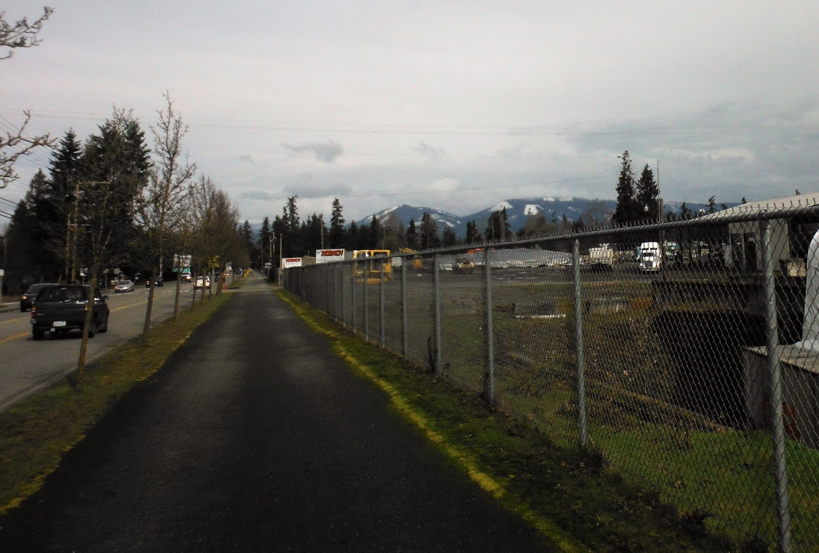
I skipped Zola's this time (remember that "eating lots of stuff at the beach" comment earlier?). Back on the Interurban Trail, it was easy to break the posted 15 mph speed limit while barely turning over the pedals. The sun and wind had dried the trail, too. This was particularly nice on the frequent railroad crossings that this trail has near Kent and Tukwilla.

Back on the Duwamish Trail, near South Park, I noticed this ghost bike.


It honors Marvin Miller, who "died doing what he loved" on this trail. Although I don't plan to do either any time soon, it's better to burn out than to fade away.

Sunday, March 11, 2018

Too Much of a Good Thing?

Saturday was the Spring Populaire for the Seattle International Randonneurs (SIR). Since it was about as perfect a March day as you could hope for in Seattle, and since I wanted to meet some of my fellow randonneurs in the area, I signed up.

We started from Woodland Park, which is near the Seattle Zoo. The park is gorgeous, with soccer fields and ball parks and Green Lake, which is popular for rowing. The neighborhood around the park is nice, too, with lovely homes and at least one very good coffee shop.


I got to the start of the ride nice and early and chatted with some of the other cyclists. It was a huge turnout, with 50-75 riders. In talking to them I learned that this was the first RUSA event for some, while others reminisced about the heat on the last Gold Rush Randonee or how they will be doing their fourth Cascade 1200 differently.

The organizers welcome us and briefed us, and reminded us that most of the route was on multi-use trails. Since the forecast was good, we would need to watch out for other folks enjoying the day there. Then, promptly at 9 am, they let us go.

With such a large group, we naturally clumped up to almost do the ride "audiax style." On the way out of town, one lady in a car took exception to the group of six or so that I was with, telling us at a red light that "you should be in cars."

She was mostly the exception, however, as the drivers in Seattle are used to bicycles and usually manage to deal with us ... although, to be fair, we didn't always deal well with them this morning. We continued to climp up at many red lights and stop signs, sometimes blocking cars from coming out as we came around them and headed for the far lane. In our minds, we we just trying to get out of their way -- but I think that, had I been in a car like the lady earlier had said I should be, I might not have seen it that way.


After passing by a marina full of sailboats heading out for a gorgeous day, and then climbing back up through Golden Gardens Park -- with a painful stop halfway to write the answer for an information control -- we passed through a series of neighborhoods. The streets were fairly quiet for 10 am on a nice Saturday, and most of the traffic was us.

It was a good group of riders. There just may have been too much of a good thing here.


Not far past our third information control, we got on the Interurban Trail going north. Then, we turned east up a short steep hill. I was at the top of the hill when somebody mentioned that there had been another information control at the bottom, so I got to enjoy the steep hill twice.

We crossed over I-5 heading east, and then enjoyed a really fun descent down towards the lake. I'd done this descent a few weeks earlier when I tried the Luck of the Drawbridges permanent, but this time I was with a small group and could follow their line. It was a blast!

At the lake we got on the Burke-Gilman Trail again, heading northeast through Kenmore before transitioning to the Sammamish River Trail. By now, this stretch has become very familiar to me, but it was nice riding it with a group. I had people to talk with, and of course riding with a group allows you -- and inspires you -- to ride a little faster.


We took the Sammamish River Trail down to Redmond, where we stopped at the Whole Foods control and everyone got something to eat and drink and sat in the sun for a bit. I had a cup of coffee and a croissant and chatted with a bunch of folks. People were leaving in bits, and I've gotten so used to short controls that I began to get antsy, so soon I headed out with two other fellows.

The three of us became four before I stopped in Woodinville to use the rest room. As I came out, another group of 10 or 12 was coming by, so I joined in with them.


Since it was about noon now, there were a lot of people out walking, biking, rollerblading, and skateboarding on the Sammamish River Trail and the Burke-Gillman Trails. Although we had a fairly well-behaved group of very experienced cyclists, it meant for a lot of surging and slowing, stopping, scooting past on the grass, bell-ringing, calling out, and post-pass apologies. We were all just trying to enjoy ourselves on this very nice day on a multi-use trail, but there was too much "multi" on what is really just a narrow winding bit of asphalt with lots of stops for crossing traffic.


Maybe we could have broken up into smaller groups, but the trail itself stymies that. You would be in a smaller group, and then you come upon a traffic jam with a family pushing a stroller and a Strava-segment seeking cyclist zipping by the other way, so that the smaller group behind your smaller group catches up and now you're a big group. The big group passes four runners nicely, with "Hellos" and "Good afternoons," when all of a sudden another training triathlete down on her aerobars comes around the corner ahead and you've go to scurry back over to the right. Then you get around the corner and there's a big group of randonneurs ahead waiting for a light to change, and abracadabra your peloton is once more massive.

Again, a confluence of good weather luring more people than had been initially forecast onto a limited facility -- too much of a good thing.


Trail traffic got even thicker as we cruised along the top of Lake Washington and past the University, and I think we were all happy to get off the trail and head inland. As we all know, however, inland means "climbing," and the route had a number of harsh face-slaps in the final miles before hitting the ultimate control at Zeek's Pizza.

It was a good group to ride with and a beautiful route on a lovely day. Apparently, the route is also a permanent, which is why there were so many information controls to keep people on the preferred roads. Had it been a March day like many other days around here, they would have been necessary; but since many of us were rarely out of sight of other cyclists and hence would not have had a chance to "take a short cut," they were just opportunities to slow down and gather our thoughts.

A more normal March day also would have made for less traffic on the trails. Was there anything that the organizers could have done differently about that? I don't think so. They warned us at the start that there would be a lot of people out that day, and that should have been obvious to us all. And you have to remember that this was a Spring Populaire -- the end-caps of the randonneuriing world, where we lure new riders in with a good route and expose them to things like route sheets, brevet cards, and controls. SIR chose a relatively flat route, with just enough climbing to keep things interesting and provide the elevation necessary for a fun descent or two. The route starting in town also made it more accessible -- I heard at least one rider say that this would be her first brevet and that "it was so close to home that I had to come."

Nobody could have foreseen sun and 60-degree temperatures for the second Saturday in March in Seattle. It was a good thing ... but it was a good thing for both cyclists and non-cyclists, and everybody deserves the right to get out and enjoy this beautiful planet on a perfect weekend.

PS: If any of you want to see video from this ride, Yogy Namara posted a video. I'm the geek in the Gran Fondo jacket.

Sunday, March 4, 2018

The Easiest 100K Yet

March came in like a lamb here in Seattle ... or maybe like a lamb kebab that's been in the fridge for a few days: Dried out and cold, but palatable. Over the years, I've learned to take what I can get, so I went out as soon as possible to get in my March 100K.

Continuing my exploratory string, I decided to do the Centennial Trail Run (RUSA 1354). The route starts in Snohomish (I've been pronouncing that exactly the way that it looks, and I am almost certainly wrong), which I had briefly visited on my last 100K. This time, however, I drove here. Tip: It takes longer to drive here than you think, particularly on a weekday.

The first control was the Snohomish Bakery (also the control from my February 100K). I'd opted for a 10 am start, in hopes of enjoying the warmest part of the day; however, the day pretty much stayed in the upper 30s and low 40s. The plus side of this was that it simplified my attire needs, since I didn't have to worry about stashing anything that I took off and/or might need later. Basically, I just stayed dressed the same all day.

As you can guess from the tip above, I got to Snohomish less than 10 minutes before my start time. I found a parking spot, got my bike out (I'd opted for Sparkletini today, just in case the rain potentials turned out to not be in my favor), ran over the bakery, scarfed something (maybe a scone? it was all so fast) and hit the road about five minutes late.


This route has much to recommend it. For one thing, it's almost entirely on the Centennial Trail, which is a rails-to-trails that connects Snohomish to Arlington and points just beyond. I've learned never to say, "you could not get lost" because I've got friends that can get lost anywhere, and I've also found that anyone can get lost on any route if they are sufficiently sleep-deprived. But, that being said, you'd have a hard time getting lost on this route.


About the time I saw this espresso stand (great thing about the Pacific Northwest -- roadside espresso stands just about freaking EVERYWHERE), I realized that I had been on this before, and on this same bike. Sparkeltini and I had used this on the first day of my four-day tour from Seattle to Vancouver. I seem to recall parts of it still being under construction then, but it is now complete and very well marked.

We'd had some strong winds out of the northeast (not the usual direction for winds here) a week before, and some of the residue from the clean-up remained. Overall, however, the trail was in excellent shape other than the usual areas where roots or improperly packed base have caused rippling and buckling of the asphalt. So long as you watch for those and keep at least one hand on the bars, however, you should be good.


I was trying to maintain a 15 mph average, and soon I was in Arlington. Although this is a nice little town, the trail here runs along one of the busier roads and you have to slow down or stop regularly for the curb cuts.


From Arlington, you start to see mountains. The tops were covered in snow, and I started to worry that I was going to have to climb at least the base of them. My fears were unfounded.


You know you're on a rail-to-trail when you go by the old station building. They're usually welcome centers like this or museums, but sometimes they're shops or restaurants.


Leaving Arlington, I stopped to get this picture of the view up the river towards the mountains.


Just before the end of the route, the trail ends. At this point, you've been on it almost 30 miles.


North of Pilchuck (not much of a town, but they do have an espresso stand), the trail ends at this lovely parking lot. There's a barn with all kinds of historical stuff that you can read when you're not trying to do a 100K in a time limit. Of course, I just got on the road.


You roll north on Washington Hwy 9 to Lake McMurray and stop at the store there. The lady there actually has a stamp for my card, just like you get at controls on 1200Ks. It was so cool.

I ate a bag of chips and drank a cold ice tea out in front of the store, but the breeze coming off the lake and my cooling body made me keep the break short.


Leaving the store, I stopped for another picture of the view of the mountains behind the lake.


Hwy 9 had a lot of logging trucks while I was on it -- at least six passed me during those five miles. The drivers all passed cleanly, however, and I've always loved the smell of sap from fresh-cut trees.


I got back on the trail at the same place, of course, and headed south. The wind had been fairly light and out of the east, so it was no help on the first leg. It shifted a little south later, so it was less help then.

Another sign you're on a rail-to-trail: You go through a swamp. For railroads, it was always flat land that they just had to build up a bit, and it was cheap.


We had a bit of snow over the past weekend. In West Seattle, it was all melted. But along the trail, in shadier sections, some of it remained.


Again, as you expect with a rails-to-trails, none of the "hills" were tough. There are really two lumps on the trail, with the first one being about 15 miles wide at its base. This meant that I had a "climb" of about eight miles at 1-2% on the way out, followed by a "descent" of another eight miles. With the wind shift, the "descent" at the end of the route was much appreciated, since it allowed me to keep my average up to 15 mph.


I got back to Snohomish right at 3 pm. The lady at the bakery knew the drill, too, and signed my card as soon as I pulled it out. She said that when it gets warmer they'll get big brevets coming through, with randonneurs out the door and everybody yelling, "Don't forget your card!"

Other than the long drive up to Snohomish and the fact that it's an out-and-back, I enjoyed this route. The trail lends itself perfectly to a 100K. And with less than 1,500 feet of climbing, plenty of shade from sun and wind, and lots of places to stop for food or drink or potty breaks, this should make a good option for any time when I need to get a "fool-proof" ride in.