Sorry that I've been away so long. Moving chores and work finally quieted down sufficiently for me to do a ride worth telling you about.
One of the first rides I did while we were moving here was to take US-41 down to Everglades City and Chokoloskee. It was scenic, but kind of boring and the traffic was not pleasant. Also, when you ride almost 20 miles in any direction in Florida and then retrace your route back, you're going to have a headwind for at least half of the ride ... maybe the whole way. It's just the way Florida works.
But I liked Everglades City as a destination, and wanted to plan it as part of a 200K loop from Naples. So, when a couple of riders here told me about a route to Ave Maria, I pulled out the maps and found an easy way to plot what I needed. Thursday, I was finally able to test it.
A lot of rides around here use Vanderbilt Beach Road to go west. It's busy, of course, but has a good bike lane.

There are also so many routes that use this road that the drivers are fairly accustomed to bicycles.

I'm not sure what the "M" route is, but it mostly followed my way to Ave Maria. You would think that, if it was the Ave Maria route, it would be "AM," but that might confuse people into thinking that they can only go that way in the morning. They might not have wanted to do just "A" since people would think it's only for the A group riders, for clubs that split into A, B, and C groups.
After going well inland on Vanderbilt Beach Road, I zipped north a couple of miles on Collier Road. Here, you have a multi-use trail, but Collier Road was not horribly busy and would have been fine.
Collier took me to Immokalee Road, which has six lanes for cars and two for bikes. It also has a multi-use trail at points, but there were enough car lanes that I never felt crowded in the bike lane. I get the impression that this road serves partly to get produce out to the coast from the inland farms, but is primarily to get people in to the casino on the reservation in Immokalee.
Traffic finally quieted down when I turned on Oil Well Road. This looks like it will soon have six lanes for cars and two for bikes, but is currently nice and quiet once you get away from Immokalee Road.

For miles, you get the feeling that you're out in the middle of nowhere. Then you get a break between the trees and realize that just beyond them are huge farms and orchards. At one point, I could see at least a full square mile of orange trees.
Eventually, you turn off Oil Well Road and enter the manicured realm of Ave Maria.

I won't go into the history of Ave Maria or what the plan for it is. Suffice to say that somebody has a vision, and it's one of those "If you build it, they will come" kinds of things.

But if you come, you'd better bring a full tank of gas, since this station ain't open yet.

This is the huge church in the middle of the town square. All around it were shops and condominiums. Just off to the west is the college campus. You can see this church from a mile away.
Fortunately, they had a full-service, operational, Publix. It was just like any other Publix in Florida, right down to selling beer and wine ... although the Catholics have never been as sticky about alcohol. I bought a fresh bottle of water, used their bathroom, and went on my way.
I took Camp Keais Road back south to Oil Well Road, then continued east to Hwy 29. I'm not sure whose route that I was on, but there were still road hickeys out. For some reason, however, they did not apparently want to ride the 35 miles on Hwy 29 down to Everglades City.

There is a store where Oil Well Road hits Hwy 29, and the above marking was indicating that I should go to that. I probably should have, because once you head south on Hwy 29, you are on your own for a long, long way.

Fortunately, the road has a good shoulder. It has these weird raised spots on the white line for much of it -- probably to keep cars from running off the road. Instead of rumble strips, they're like rumble pimples.

At one point I actually came across some trees that were changing color. In Florida! Imagine that.

Much of the road goes through the Florida Panther National Wildlife Refuge. There are miles and miles where the road is fenced off, so that panthers don't wander into the road. There are also some nice underpasses, just so that they can get from one side to another.

I didn't see any panthers, of course. But at least I didn't see any road kill panthers.
The wind was somewhat behind me on most of this stretch, so I was doing 22 mph and barely working. I knew that I would have to pay for it eventually, but sure enjoyed it while I had it.

When you come to I-75, you're almost halfway down this long stretch. There are some trucks on this road, but they seem to be heading for the interstate. South of it, the road is more quiet.

There's a nice sign to remind you of how far you have to go before you can fill your bottles.

There are also signs to tell you to slow down for panthers. I was very careful.

The further south you go, the swampier it gets. When you can see the radio tower, you know that you're almost to US-41.

I got to Everglades City about noon -- almost 70 miles in less than four hours. Eating a sandwich at Subway, I began to think that it would not be difficult to do this 200K in less than eight hours, even riding solo.
The wind, however, had other ideas. It made them very clear to me as I began my way northwest on 41.

Those of you who know how to read clouds probably recognize that as the leading edge of a high pressure cell. That usually means that winds are roughly out of the north down my way. So, I slogged along at 15 mph for the next 18 miles, doing my best to tuck low.
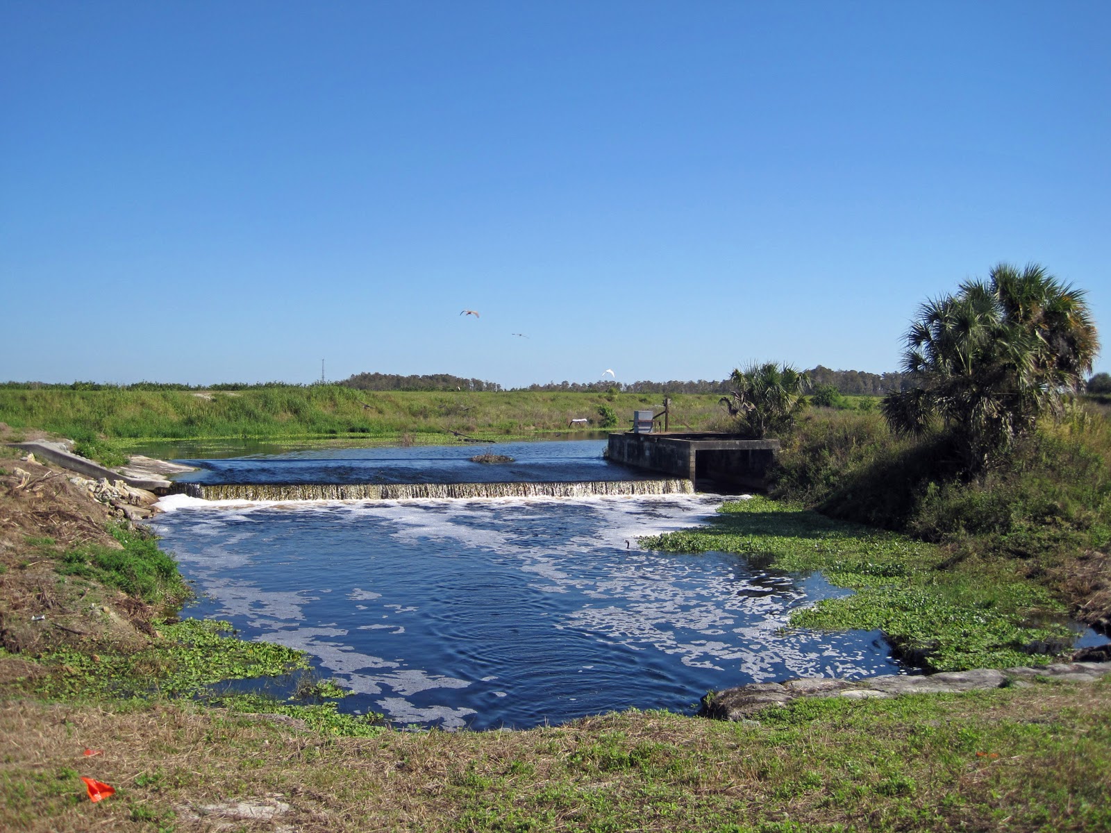
I did pass through some pretty spots, of course. This is a planned community along one of the canals that manages the water flow in the Everglades.

There are even some good-sized sailboats at the marina, so there must be deep-water access.
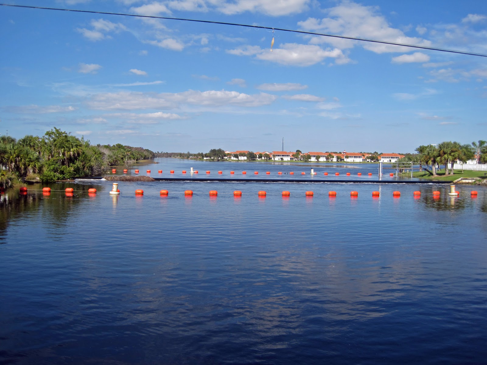
Finally, I got to San Marco Road. I stopped at the store for more water, and then headed southwest for a few miles. It was a nice break, and allowed me to work my climbing legs as I headed over the bridge on to Marco Island.

The marina on the far side of the bridge still has lots of room for the snow birds.

Past the bridge, the road started north again. You get a quiet stretch for a few miles -- other than those crazy gopher tortoises -- and then stop at a convenience store for one last bottle fill. Then, it's dead north on busy Collier Road for about 10 miles, followed by mostly dead north on busy US-41 for 10 miles.

After that, I felt like road-kill tortoise myself.
I thought you would complete-the-foreshadowed time circle. I.e., how long did the entire ride take?
ReplyDeleteHemingway stressed that it was "the thing not said" that helped the reader better put him- or herself into the story. Of course, I was just ashamed to admit that it took me 8:15 to finish. Of course, that included a couple of bonus miles when I missed a turn, but even then ...
ReplyDeleteWow. A lot of "of courses" there ... Particularly for someone who was Off Course! Ha-ha-ha. I kill me.
ReplyDelete